I have recently taken up sailing on Lake Michigan, and as part of the sailing we need to learn about and be aware of the depth of the water we are sailing in. As we sail in Ensign sailboats with very long keels, the boat can get grounded if you do not sail in deep enough water.
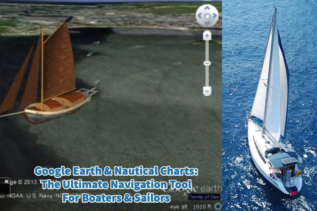
Google Earth and Nautical Charts are two essential tools boaters, or sailors can use to help them plan a safe journey and navigate through waters, especially waters unfamiliar to them. A good sailor and boater must understand nautical charts. Many sailors and boaters will use the tools of Google Earth and their nautical charts to plan their journey correctly.
Table of Contents
- The Importance For All Boaters To Understand Nautical Charts
- Ways To Use Google Earth For Sailing And Boating Navigation
- Related Questions
The Importance For All Boaters To Understand Nautical Charts
For sailors and boaters, understanding nautical charts is essential to navigating safely and efficiently through unfamiliar waters. Nautical charts are specialized maps explicitly designed for use on the water, and they contain a wealth of information about water depth, hazards, navigational aids, and other essential features of the waterway.
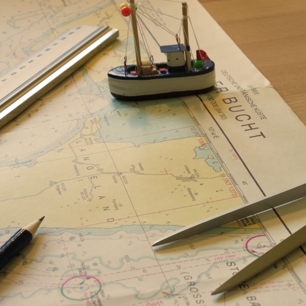
Scale Is An Important Element Of Nautical Charts
One of the essential elements of a nautical chart is the scale. This represents the ratio between the distance on the chart and the actual distance on the water. Understanding the scale is critical for measuring distances accurately and determining the time required to reach a destination.
Nautical Charts And Symbols
Understanding the symbols used to represent features on the chart is essential so you know what the symbols mean. These symbols may include navigational aids, obstructions, underwater features, and other important information.
Knowing how to read and interpret these symbols is critical for safe navigation.
Nautical Charts Help You Know The Water Depth
Another essential feature of a nautical chart is the depiction of water depth. Depths are shown in feet or fathoms and are indicated by contour lines that connect points of equal depth. The chart also shows the locations of shoals, reefs, other hazards, and navigational aids such as buoys, beacons, and lighthouses.
The Story Of The Lovesick Sailboat That Got Beached Boat At Bradley Beach In Milwaukee
When I recently took a course at the Milwaukee Community Sailing Center about how to read a nautical chart, the instructor told a story about a sailboat that ended up on Bradley Beach in Milwaukee.
As the story goes, a Polish man built a beautiful wooden sailboat. His dream was to eventually sail the boat to Poland so that he could make the romantic gesture of asking his girlfriend to marry him.
He decided to take the sailboat north or towards Port Washington. But he never bothered to check a map and see the water’s depth for the route he was planning to sail.
He took his boat out of the McKinley Harbor in Milwaukee and turned left to go to Northern Lake Michigan or towards Port Washington. He only sailed a few hundred meters before his boat beached on Bradley Beach.
If he had read a nautical chart before planning his route, he would have seen on the nautical charts that the Bradley Beach area of Lake Michigan in Milwaukee was relatively shallow.
Instead of turning straight left, she should have gone further northeast on Lake Michigan to get to towards Port Washington. If he had done this, and correctly read a nautical map, and understood the depth of the water compared to the keel size of his sailboat, he would not have had a problem.
Nautical Charts Help You Understand The Water You Are Boating Or Sailing
When planning a voyage using a nautical chart, it is essential to consider the specific conditions of the waterway, such as the tides and currents. These can significantly impact navigation, and understanding them is critical for planning a safe and efficient voyage. Boaters should also be aware of any hazards or restrictions in the area, such as bridges, channels, or restricted areas.
Understanding nautical charts is essential for safe and efficient navigation on the water. Elements such as scale, depth, and symbols provide critical information for planning a voyage and avoiding hazards. By familiarizing themselves with nautical charts and the features they contain, boaters can enjoy a safe and successful journey on the water.
Ways To Use Google Earth For Sailing And Boating Navigation
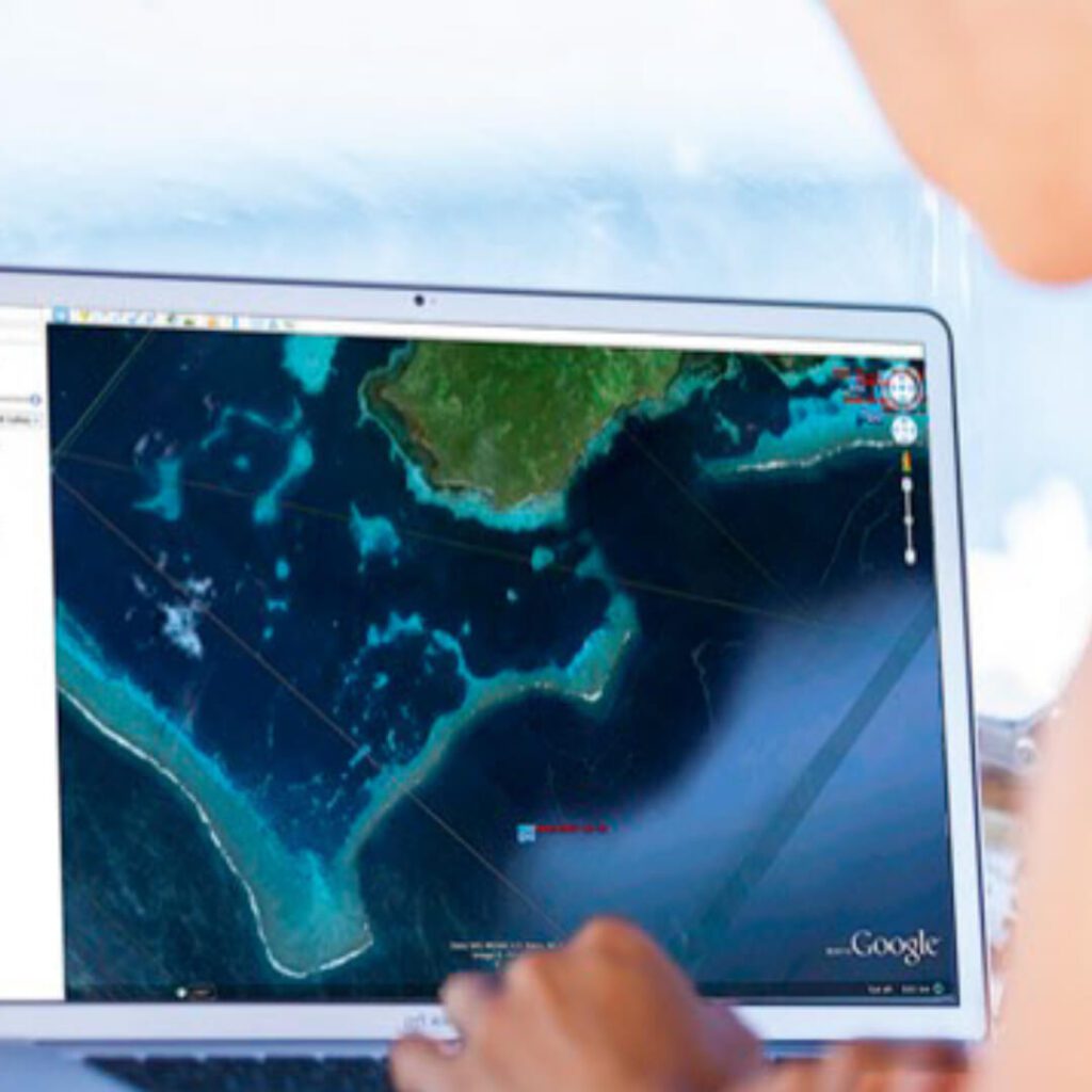
Google Earth is a powerful tool for sailors and boaters that provides information about waterways and coastal areas. This web-based platform uses satellite imagery to create detailed maps of the Earth’s surface, allowing users to zoom in and explore any area in detail.
For sailors and boaters, Google Earth can be a valuable tool for planning a voyage and understanding the conditions of the waterway.
Google Earth Helps Boats And Sailors Plan Their Voyage
Using Google Earth, boaters can view satellite images of the waterway they plan to navigate and get a sense of the terrain and coastal features in the area. This can be particularly helpful for identifying potential hazards or obstacles in the water, such as submerged rocks or sandbars.
Google Earth can also plan routes and identify potential anchorages or other points of interest.
While nautical charts remain the gold standard for navigation on the water, many experienced boaters and sailors use Google Earth and along with the nautical charts to map their journey. This allows them to get a complete picture of the waterway and identify potential hazards or challenges that may not be apparent from a nautical chart alone.
Additionally, Google Earth can provide a valuable visual reference for navigating complex waterways, such as narrow channels or river mouths.
Google Earth is a powerful tool for sailors and boaters, providing detailed satellite imagery of coastal areas and waterways. While it should not replace nautical charts, it can be a valuable supplement for planning a voyage and identifying potential hazards or obstacles in the water.
At A Bus On A Dusty Road, we talk about everything about the culture, travel, life, sailing, and ex-pat living. We are all about “Living Life As A Global Citizen.” We explore social, cultural, and economic issues and travel.
We would love to have you be part of our community. Sign up for our newsletter to keep up-to-date by clicking here. If you have any questions, you can contact me, Anita, by clicking here.
Listen to our Podcast called Dusty Roads. You can find it on all major podcast platforms. Try out listening to one of our podcasts by clicking here.
Subscribe to our A Bus On A Dusty Road YouTube Channel with great videos and information by clicking here.
Related Questions
How Much Wind Is Too Much For A Beginner Sailor?
For a beginner sailor, the wind is usually recommended to be under 10 knots. Those who are more experienced or with a larger boat can consider going up to 12 knots of wind. A knot is not the same as miles per hour or kilometers per hour but is faster than these measurements.
By clicking here, you can discover How Much Wind Is Too Much For A Beginner Sailor?
How Old Ships Sail Without Wind In The Ancient Times?
If the ancient ships had no wind, they could not move forward unless they rowed or got pulled somehow. Wind for the ancient vessels was significant, or they would remain in what was known as becalmed or without wind.
By clicking here, you can discover How Old Ships Sail Without Wind In The Ancient Times?
No Experience Sailing, 6 Tips To Get Started
If you are going to take up sailing, you first must get on a boat and find out if sailing is suitable. The best sailors can handle their boats in all kinds and types of weather. Find a class that you can join and get certified. Sailing requires knowledge and skill. Find yourself a sailing community that you can be part of.
By clicking here, you can discover No Experience Sailing, 6 Tips To Get Started.