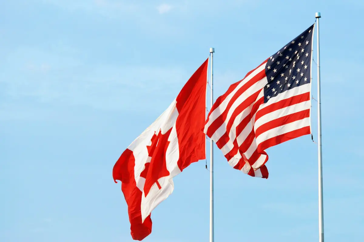
The journey through the history and geography of the USA-Canada border reveals a tapestry woven with the threads of diplomacy, environmental stewardship, and community life.
This narrative sheds light on how a line on a map transcends its physical presence to influence ecosystems, economies, and daily human interactions in profound ways. The unfolding story of this boundary offers insights into the challenges and cooperative efforts that have shaped its current state, reflecting a broader understanding of international relations and environmental conservation.
Table of Contents
- Historical Evolution of the Boundary
- Geographical Features and Challenges
- Cross-Border Communities and Cooperation
- Boundary Security and Management
- Environmental Conservation Efforts
- Related Questions
Historical Evolution of the Boundary
The dividing line between the USA and Canada wasn’t always straightforward. In the 1600s, European settlers didn’t draw firm lines; it was all somewhat fuzzy. Fast-forward to 1783, and the Treaty of Paris changed things, setting the stage by drawing early boundaries post-American Revolution, but still, a lot was left undecided.
Come the War of 1812, it became apparent that more precise lines were needed to avoid disputes. The Treaty of Ghent 1814 ended the war but didn’t resolve the border fuss.
The real game-changer came with the Oregon Treaty of 1846. This treaty established the 49th parallel as the primary border from the Rocky Mountains to the Strait of Georgia. This line was straight and easy to identify, making it a cleaner division than ever before.
Even with these agreements, not everything was resolved. For instance, take the contentious issue around the Alaska Panhandle. In 1903, a joint British-Canadian-American tribunal had to step in to precisely outline which fjords and inlets belonged to whom, a decision that favored the US and solidified the boundary seen today.
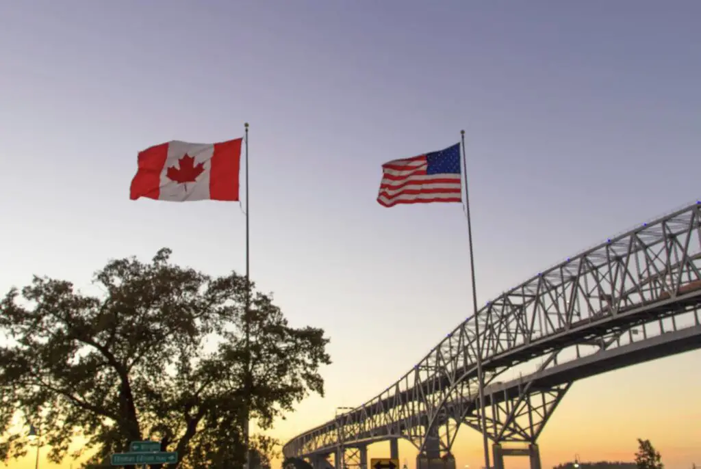
Over time, the border has witnessed adjustments for practical reasons. When dams were built or natural landscapes changed, both countries had to negotiate modifications. This spirit of cooperation reflects the unique relationship between the two nations, often summarized by the term “the longest undefended border in the world.”
Technological advances have helped, too. From simple surveying equipment to GPS, the precision with which the boundary is marked has improved, adapting to both countries’ needs without significant conflicts.
Each change and negotiation echoes the evolving relationship and mutual respect between the USA and Canada. The boundary, spanning various terrains from dense forests to bustling cities, is a testament to centuries of diplomacy and problem-solving, a line that defines not just geographical spaces but a shared history and future aspirations.
What makes this border particularly interesting is its effect on daily life. In some places, towns and communities on either side of the boundary are intricately linked, with families and social life sprawling across national lines, highlighting a blend of cultures that enrich both countries.
Despite its calm appearance, the evolution of the USA-Canada border is a complex tale of overcoming challenges through dialogue, respect for sovereignty, and a shared vision of peaceful coexistence. As history marches on, this border may see new adjustments. Still, the foundation of cooperation remains steadfast, paving the way for future generations to navigate their shared geography and intertwined destinies.
Geographical Features and Challenges
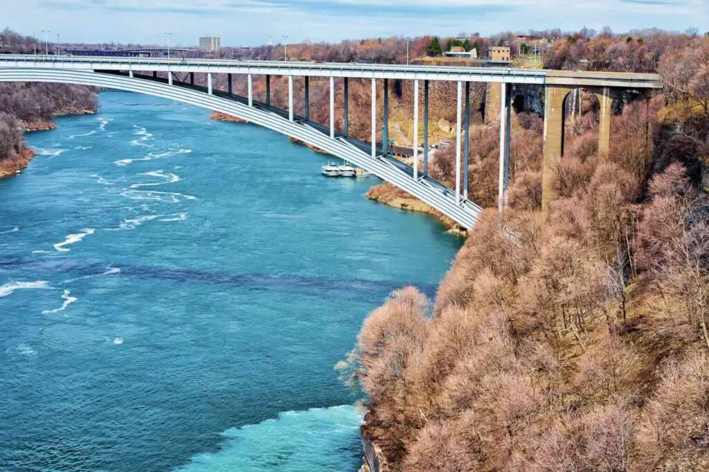
The Great Lakes, a set of five interconnected freshwater bodies, form a significant border segment between the USA and Canada. These lakes are vital for both nations’ economies and raise water rights and environmental protection issues. The challenges here involve managing a natural and human-defined boundary, requiring binational agreements to regulate water use, fisheries, and pollution control to preserve the lakes’ health and sustainability.
Moving westward, the 49th parallel is an invisible line separating two vast nations across plains and mountains. While this distinction is clear on maps, it crosses rugged terrains and remote areas. The challenges in these regions are less about daily governance and more about maintaining clear markers that can withstand weathering and environmental changes. This requires periodic surveys and potential adjustments to ensure the boundary markers are visible and accurately placed.
The Rocky Mountains present their unique challenges as a natural defining boundary feature. This mountain range poses physical hurdles for differentiation and maintenance and affects weather patterns, leading to additional considerations for cross-border projects or cooperation. The complexity increases with natural preservation efforts, as this area is home to diverse wildlife whose habitat spans the international border.
An interesting outlier in the geography of the USA-Canada border is the Northwest Angle in Minnesota. Accessible from the mainland United States only by traveling through Canada or across Lake of the Woods, this area illustrates the complexities of living in a region with an unusual boundary.
Residents face difficulties from simple daily tasks, such as accessing essential services, to more complex issues like voting in U.S. elections. Services and regulatory agencies must navigate these anomalies carefully to meet the resident’s needs without compromising national integrity.
Environmental concerns crown the challenges along the USA-Canada border, stretching from the Great Lakes to the Rocky Mountains and beyond. Climate change threatens these natural boundaries, potentially altering landscapes, water levels in lakes and rivers, and biodiversity in these regions.
The transboundary nature of environmental issues necessitates concerted efforts from both countries to address pollution, conserve habitats, and respond to climate-induced changes to ensure the border’s resilience in the face of global environmental shifts.
These geographical features and corresponding challenges highlight the importance of collaboration between the USA and Canada. Both nations strive to tackle technical, environmental, and practical issues, ensuring the border remains a symbol of peace and cooperation rather than conflict or division.
The interconnectedness of landscapes, ecosystems, and communities along this boundary underscores the requirement for a bilateral approach to solve the unique problems presented by this diverse and complex frontier.
Cross-Border Communities and Cooperation
Cross-border communities along the USA-Canada boundary, like the Akwesasne Mohawk Nation and the twin towns of Derby Line, Vermont, and Stanstead, Quebec, embody a blend of shared culture with a clear marker of national divide.
These communities live a somewhat different day—to—day reality. They wake up in one country and might commute to another for work, school, or even a quick grocery run. Imagine your neighbor living under a different flag a stone’s throw away; it’s fascinating and peculiar.
The Akwesasne Mohawk Nation operates under unique sovereignty laws, managing its affairs across American and Canadian territories. This has led to creative governance approaches that respect traditional land rights while navigating a complex web of federal laws.
Education systems in this region mirror this duality, offering curricula covering both countries’ histories and cultures. What does this mean? Before lunchtime, students can learn about the American Revolution and the War of 1812 from two perspectives.
Economic interactions along the border stretch thrive on cross-border shopping and employment. Retailers in towns like Derby Line and Stanstead often accept both U.S. dollars and Canadian dollars, making transactions seamless for consumers.
Work laws permit residents to cross back and forth for employment, though they must abide by the labor laws of the employing country. This intertwined economic relationship fosters strong ties but requires residents to be well-versed with national regulations and exchange rates.
Social interactions blur the international lines even further. Family ties often stretch across the border, leading to cultural practices being shared and celebrated together—Thanksgiving might be celebrated twice in these households! In some instances, public services are shared; libraries and recreational facilities serve residents of both nations, underscoring the community-first attitude transcending political boundaries.
On the legal side, emergency services have protocols that allow them to cross the border without customs procedures in emergencies. Police and fire departments collaborate closely to ensure the safety and security of the entire community, irrespective of the border. This level of cooperation underlines the brotherhood among these towns and tribes, providing a unique precedent for international relations.
However, it’s not all smooth sailing. The border still presents logistical challenges, with tighter security measures occasionally affecting the fluid movement. The reality of living in a border community involves regular encounters with border security agencies and understanding the nuances of cross-border legalities, a skill set some might say you’d only get in places like Derby Line or Akwesasne.
The pacing of life is surprisingly synchronized, showing that despite the robust presence of an international border, daily life in these communities focuses more on shared experiences than divisions. Festivals, markets, and cultural events typically see attendees and participants from both sides of the border, spotlighting a unity that might leave outsiders envious.
In these communities, we see a living example of how historical decisions about lines on a map have directly shaped human lives. The resilience and adaptability of these cross-border towns and tribes reveal how communities can thrive amidst a dual national identity. They carry forward a legacy of collaboration and mutual respect that transcends geographical boundaries—a daily dance of navigation that symbolizes a peaceful coexistence worth emulating globally.
Boundary Security and Management
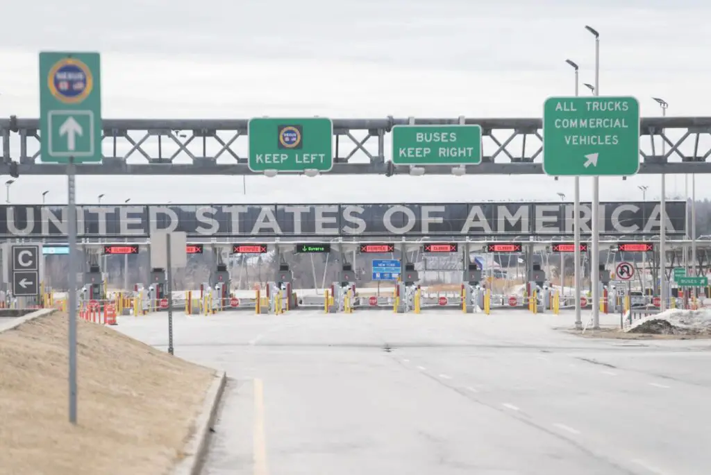
The International Boundary Commission (IBC) is pivotal in managing the USA-Canada border, ensuring the invisible line separating these neighboring nations remains clear and intact.
Jointly established by the United States and Canada, the IBC is tasked with mapping and maintaining the nearly 8,891 kilometers (5,525 miles) stretch from coast to coast. Its responsibilities include everything from resolving disputes over where the actual boundary lies to keeping the border vista—a six-meter-wide space clear of trees and bushes along the land boundary—free of natural overgrowth.
Technological surveillance plays a significant role in monitoring this expansive boundary. Both countries are dedicated to preventing illegal crossings and smuggling activities, utilizing everything from high-resolution cameras to drones and radar systems. These technologies enable border agents to detect movements in remote areas where it would be otherwise challenging to maintain a constant human presence.
Efforts to secure the border also extend to collaborative initiatives targeting smuggling—whether it involves drugs, weapons, or human trafficking—and other illegal activities. Joint operations between agencies like the U.S. Border Patrol and the Royal Canadian Mounted Police share information and resources, streamlining efforts to tackle these cross-border challenges efficiently.
Although significant focus is placed on security, there’s also a strong emphasis on facilitating smooth trade and travel between the USA and Canada. The NEXUS program exemplifies this commitment to efficiency by providing pre-screened travelers with expedited processing when they cross the border. This improves the flow of legitimate travel and commerce and allows for more focused attention on potential security threats.
Another essential component in managing the USA-Canada border involves the cooperation between the two countries on environmental and natural resource concerns. The boundary traverses diverse ecosystems, from the vast Great Lakes to dense forests, requiring concerted conservation efforts. Binational agreements like the Boundary Waters Treaty champion these efforts, focusing on water quality and habitat preservation—an acknowledgment that environmental stewardship is fundamental to border management.
A critical realization in the dialogue surrounding the USA-Canada boundary is its demonstration of how security initiatives can coexist with measures to ensure environmental protection and facilitate beneficial economic interactions. This harmonious approach has made the USA-Canada border one of the most interesting international delineations and offered a template for international cooperation worldwide.
Environmental Conservation Efforts
Expanding on efforts for conservation and environmental protection along the USA and Canada border, the two nations have also come together under the umbrella of the Flathead River Basin Agreement.
This agreement is a testament to their commitment to protecting pristine waters and diverse ecosystems from potentially harmful resource development. The Flathead River spans both countries and is remarkable in natural beauty and ecological significance. Through this pact, the two countries agree to safeguard the river’s quality and surrounding environment, a critical habitat for many species.
Another flagship initiative that highlights cross-border environmental collaboration is the Great Lakes Restoration Initiative (GLRI). Launched in 2010, the GLRI is a concerted effort by both countries to restore and protect the Great Lakes ecosystem. The Great Lakes are not only a shared resource between the USA and Canada but are also vital to the health and well-being of millions living in the Great Lakes basin. This initiative targets key issues such as combating invasive species, reducing nutrient runoff contributing to harmful algal blooms, and restoring habitats to protect native biodiversity.
Ongoing joint scientific research and monitoring play a crucial role in understanding the impacts of climate change along the shared boundary. Researchers from both nations collaborate extensively to study environmental trends, share data, and develop models to predict future changes. This collective effort is vital for making informed decisions about managing water resources, protecting against invasive species, and preserving natural landscapes across borders.
Shared biodiversity conservation projects are another area where the USA and Canada have found common ground. Recognizing that ecosystems do not adhere to man-made boundaries, these projects focus on preserving transboundary wildlife corridors and habitats essential for wide-ranging species such as grizzly bears, wolves, and migratory birds. This cooperation allows for comprehensive planning and implementation of conservation strategies that benefit biodiversity on a continental scale.
The USA and Canada also collaborate on efforts to combat climate change impacts. Initiatives focusing on reducing greenhouse gas emissions, promoting clean energy alternatives, and enhancing resilience to climate change effects underscore the shared responsibility in addressing this global challenge. Through various agreements and partnerships, both nations are committed to setting and achieving ambitious climate targets, ultimately contributing to global efforts in mitigating climate change impacts.
This cooperative approach between the USA and Canada in preserving the natural environment along their shared boundary illustrates a profound recognition of interdependence regarding environmental stewardship.
Each initiative, from river basin agreements to joint conservation projects, highlights mutual interests in safeguarding water resources, protecting biodiversity, and tackling the adverse effects of climate change. Such collaboration sets a powerful example for cross-border environmental cooperation and ensures the enduring health and beauty of the natural landscapes that define the USA-Canada border.
The evolution of the USA-Canada border is a testament to the power of cooperation and mutual respect between nations. Through centuries of shared history, environmental challenges, and community ties that cross this boundary, both countries have demonstrated a commitment to maintaining a border that is more than just a division on a map.
It is a living symbol of peace and collaboration that continues to adapt to the needs of both nations and their people, ensuring that this shared frontier remains a model for international relations around the globe.
At A Bus On A Dusty Road, we talk about travel, life, and ex-pat living. We are all about “Living Life As A Global Citizen.” We explore social, cultural, and economic issues and travel.
We would love to have you be part of our community. Sign up for our newsletter to keep up-to-date by clicking here. If you have any questions, you can contact me, Anita, by clicking here.
Listen to our Podcast called Dusty Roads. You can find it on all major podcast platforms. Try out listening to one of our podcasts by clicking here.
Subscribe to our A Bus On A Dusty Road YouTube Channel with great videos and information by clicking here.
Related Questions
What Is The Official Language Of Hong Kong?
The official language of Hong Kong is Chinese and English. The residents of Hong Kong are native Cantonese Chinese speakers, so the official language is Cantonese Chinese. Many in Hong Kong can also speak Mandarin Chinese; many local Hong Kong residents prefer to speak Cantonese Chinese or English.
By clicking here, you can discover What Is The Official Language Of Hong Kong?
How Similar Are The Chinese And Vietnamese Languages?
Both Vietnamese and Chinese are Asian languages though they come from different language families. Vietnamese and Chinese are both tonal languages and have similar sentence structures. They are monosyllabic languages, meaning that one word has one syllable and several dialects are spoken.
By clicking here, you can discover How Similar Are The Chinese And Vietnamese Languages?.
10 Reasons You Can Live In Hong Kong And Only Speak English
You can live in Hong Kong and speak only English. Many Hong Kong people speak English. Hong Kong is a former British Colony, so English is one of the official languages. In Hong Kong, the police, courts, restaurants, banks, and shops, people will usually speak English; many schools are English-speaking.
By clicking here, you can discover 10 Reasons You Can Live In Hong Kong And Only Speak English.